Mt Gulugod Baboy, Mabini, Batangas is a small to medium size mountain that is only 525 masl, according to some mountaineer's posts. It is one of the 3 peaks in our area's mountain range, but Mt Gulugod Baboy stands out as its common name. It is the Tagalog term for "pig spine", specially when viewed from the eastern section approach from Malimatoc I. I have long been climbing it in the past from the same direction, which was a steep incline from the foot of the mountain. Last December before the year ends my sisters and niece decided to climb again, because it would be colder this time, the most convenient time to go there. Moreover, my sister already based in Auckland, NZ wants to climb it again. You might ask why i go there often. Literally, it is in my a "bit wide backyard"!
I have done a
few climbs there in one year a few years back to compare the differences in vegetation, environmental conditions. Every climb is unique in some ways, and i have documented them in some previous posts in my other blog. This time i didn't expect that it will present to me a personality i still haven't encountered yet. It never fails to amaze me, and sustain my enthusiasm!
One of the differences is that a concrete road now directly stops past the small village, at the midsection between Gulugod Baboy and Pinagbanderahan. These are the 2 peaks which are easily reached. The 3rd peak is Tore, which is a bit far to the Southwest and more difficult, not even the cattle raisers go there on purpose. In the past we directly climb at the East side of Gulugod Baboy through some shortcut paths paved by the cattle owners.
view to the NE shows as far as Mt Maculot, Calaca, Batangas
We left at 6:30 am and were already there after 20 min, via a rented tricycle. My niece and her mother followed later on foot because my sister still cooked some snacks for us.
Climbing an inclined road past the village shows this Pinagbanderahan Peak to the right. A little lookout and leveled ground was constructed for ease to parking vehicles. At the moment, cows are parking themselves there. To tell you frankly, i haven't been to the top of this peak, this time we attempted to, but the cows don't leave the path deterring us to continue.
A 360-degree view provides a lovely geographic indication of landmarks as far as Mindoro, to Laguna, and Cavite. Top photo shows a part of Balayan Bay, where the Mabini Marine Sanctuary, scuba diving and the Windsurfing sites were located.
This is the Pig Spine, viewed from the east side but at a different angle. The actual Pig Spine or Gulugud Baboy has been shown nicely in one of my previous posts. Can you see the cow at the top left side of the photo?
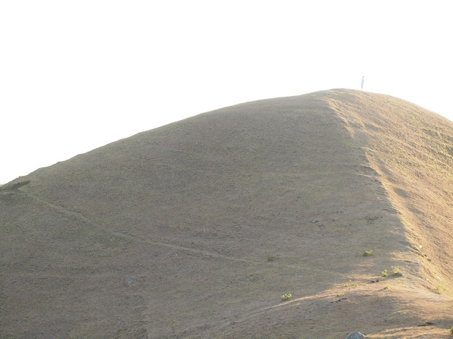
This is the new path to Gulugod Baboy Peak from the end of the new road, as well as from hiking through Philpan at the West of the mountain. My other sister is the small figure on top, she was so intent in going there first because she hasn't been here all her life.
At about 8:30am the fogs arrived, and it was really cold. We were prepared with sweaters and hats. Only my sister, who is comfortable with winter, was in short pants. The peak at the horizon is Tore or tower.
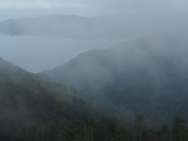
Fogs came in dense as to just give us a 5 meter radius visibility. We were having fun and joked that we might not be able to leave if the fog continues to descend thicker.
This is the actual Gulugod Baboy or pig spine, however the fog didn't allow us to see it clearly.
An old photo in 2010 during the dry season shows the "pig spine" incline. I normally came here with my nephew, that time was only a school boy, now he is already in college. The above is the normal picture when grasses are almost totally scorched during the peak of the dry season.
Only a few trees are growing because cows graze the land, and trample on new saplings.
We are already on our way back from Gulugod Baboy this time, traversing the somewhat wide divide between the two peaks.
Another small promontory where we took turns in taking photos and being models.
At 10:00am when we were already back near the road, the fogs already dispersed, giving us a lovely blue sky.
To the SW we can now see as far as the Maricaban Islands, Isla Sombrero, and blue silhouette of Mindoro island.
This is a photo taken in 2010 during the dry season, through the East view showing Mabini Town proper, on the way to Bauan to San Pascual and Batangas City, almost following the seashore. The Batangas City International Pier is also at the horizon, at the other side of Batangas Bay. That is the route to Mindoro and Romblon.
This is the village in Bagalangit, Mabini, Batangas, where many resorts are also located. There are also boats that bring tourists to the islands. Philpan Crossing where the hikers start is also below this area. This hike route takes 1.5 to 2 hrs depending on capacity of hikers. The route via Malimatoc I, at the east side of the peninsula, where we are located, needs only 10-20 min hike because vehicles stop just at the foot of the 2 peaks.
This climb didn't disappoint us, as i experienced another personality of the mountains. It is nice if you go there early or when tourists are not plenty. Being from the nearby area, we know when people go there in droves, just like during Holy Week or weekends during the dry season. It is so full of hikers and campers during those time. So when the temperatures are cold and visibility is not very good, it is the time for us to climb, so we can be on our own. And we did.
Route Options:
1. via Anilao route thru Philpan Crossing- around 2 hrs hike depending on capacity of hikers
2. via Gasang-Malimatoc I route - tricycles from Gasang can bring you already there, only a few meters to the peak of both Pinagbanderahan and Gulugod Baboy, hike of maybe 5min to the peaks.
Post Script: Due to some messages asking me the details of this Route 2, i am posting this reply. From Batangas City Grand Terminal:
a) take a jeep to Mabini, get off at Palengke or in front of Plaza, then another jeep to Gasang, tricycles will bring you to the mountain, or
b) take a jeep to Batangas City (Balete-Batangas jeep), get off at Diversion Crossing before reaching the City, and wait for a jeep to Gasang.
Note: These 2 routes separate in Mabini Crossing, near Poblacion. To the right is route 1, while to the left passing by Mabini Plaza is route 2.
My Previous Posts of Mt Gulugod Baboy:
Dry Season Scenes
Gulugod Baboy with the Islands
Grasses of Mt Gulugod Baboy
Mountain in my Backyard
Golden Love Grass in Gulugod Baboy


